
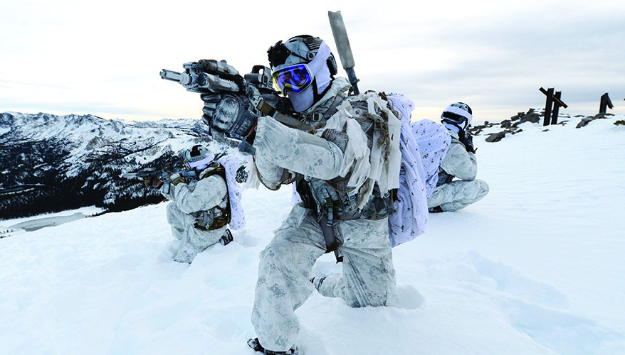
U.S. Special Operations Command North deployed personnel across six locations in western Alaska between August 15 and 31 for Operation Polar Dagger 2026, an annual exercise testing how quickly small teams can establish and sustain a forward presence along the Bering Strait. The most exposed site is Little Diomede Island, sitting just a few kilometers from Russia's Big Diomede across the strait, with Wales, Tin City, St. Lawrence Island, Nome, and Point Hope rounding out a dispersed chain running from the Bering Sea into the Chukchi Sea. The exercise builds directly on Exercise Tundra Merlin, which staged F-35As, F-16s, a HIMARS launcher, and an AN/TPQ-53 radar through Nome in late July, and SOCNORTH has framed the pairing as testing whether small, forward-positioned teams can extend situational awareness into terrain too vast and remote for larger formations to hold continuously.
What that framing understates is just how asymmetric the underlying Arctic infrastructure picture actually is between the two sides this exercise is implicitly testing readiness against. The United States has never maintained a permanent military base within the Arctic Circle on its own soil, according to reporting cited by Business Insider's Arctic infrastructure review, despite Alaska extending well into it; American Arctic presence runs through a small number of installations like Eareckson Air Station's early-warning radar rather than a distributed base network. Russia's posture across the same stretch of water is the mirror opposite: CSIS has documented a deliberate buildup dating to 2014 that reopened 50 former Soviet-era Arctic bases, added 13 air-defense radar stations, and established a dedicated Northern Fleet Joint Strategic Command, with specific facilities at Wrangel Island, Cape Schmidt, and Kotelny Island sitting directly across the Bering Strait from Alaska. The Ushakovskoye facility on Wrangel Island alone, roughly 480 kilometers from Alaska, reportedly houses dual Sopka-2 air-surveillance radars and supporting infrastructure, and CNN reporting citing Maxar satellite imagery has separately documented bombers, MiG-31BM interceptors, and underground storage facilities distributed across Russia's Arctic coastline.
That contrast reframes what Polar Dagger is actually testing. This isn't primarily an exercise about projecting new American capability into unclaimed Arctic space, it's an exercise about whether small, temporary U.S. teams can establish situational awareness in a region where the other side already operates permanent, hardened installations with dedicated radar coverage and combat aircraft on continuous or near-continuous alert. Russia's provocations in the immediate vicinity aren't hypothetical either: the National Interest has reported nuclear-capable Russian bombers flying off Alaska's coast as recently as within the past year, activity Pentagon officials have characterized as a serious and closely monitored threat pattern rather than routine patrol traffic.
The dispute over Wrangel Island itself adds a genuinely unresolved legal wrinkle to this asymmetry that rarely makes it into coverage of exercises like Polar Dagger. The United States formally claimed the island in 1881 under the Guano Islands Act and never explicitly renounced that claim, even as Russia has administered and now militarized it as part of Chukotka since the Soviet era, a dormant sovereignty dispute that gives Washington a technical, if practically unenforceable, historical basis to contest Russian military construction there. Whether or not that claim carries any real diplomatic weight today, it underlines how much of the current Arctic military geography, radar sites, bomber bases, disputed islands, was largely settled by Russian infrastructure investment over the past decade while American Arctic posture stayed comparatively minimal until relatively recently.
Polar Dagger and Tundra Merlin together suggest that calculus is now shifting, layering special operations forces, fighter aircraft, long-range fires, and radar coverage into the same western Alaska geography in a way that at least begins addressing the infrastructure gap CSIS and other Arctic analysts have flagged for years. But a two-week exercise testing whether small teams can establish and sustain contact from remote islands is still a meaningfully different starting position than the permanent, radar-equipped, bomber-capable network Russia has spent over a decade building directly across the strait, and closing that gap will require considerably more than an annual August deployment to genuinely change the underlying Arctic balance this exercise is quietly testing itself against.

No comments:
Post a Comment